City atlas De Wit
City atlas De Wit is the Google Earth of the 17th century. You can find almost every house, every tree and every back garden in the cities of the Low Countries in it. Look up your place of birth in the old centre of Leiden, for example, or see how the laundry is laid out to dry in the fields outside The Hague.

Browse through this masterpiece
City Atlas De Wit: an extremely heavy atlas
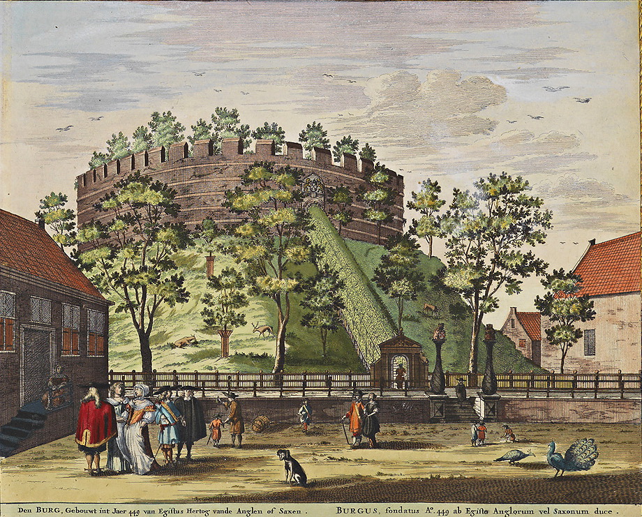
The castle in Leiden
The City atlas De Wit is a city atlas with maps and prints of important monuments in Dutch cities. Such atlases were popular among wealthy citizens and nobles in the 17th century. They were not intended to be taken with you on a city walk, as they are enormous and heavy. This particular atlas weighs no less than 7 kilograms.
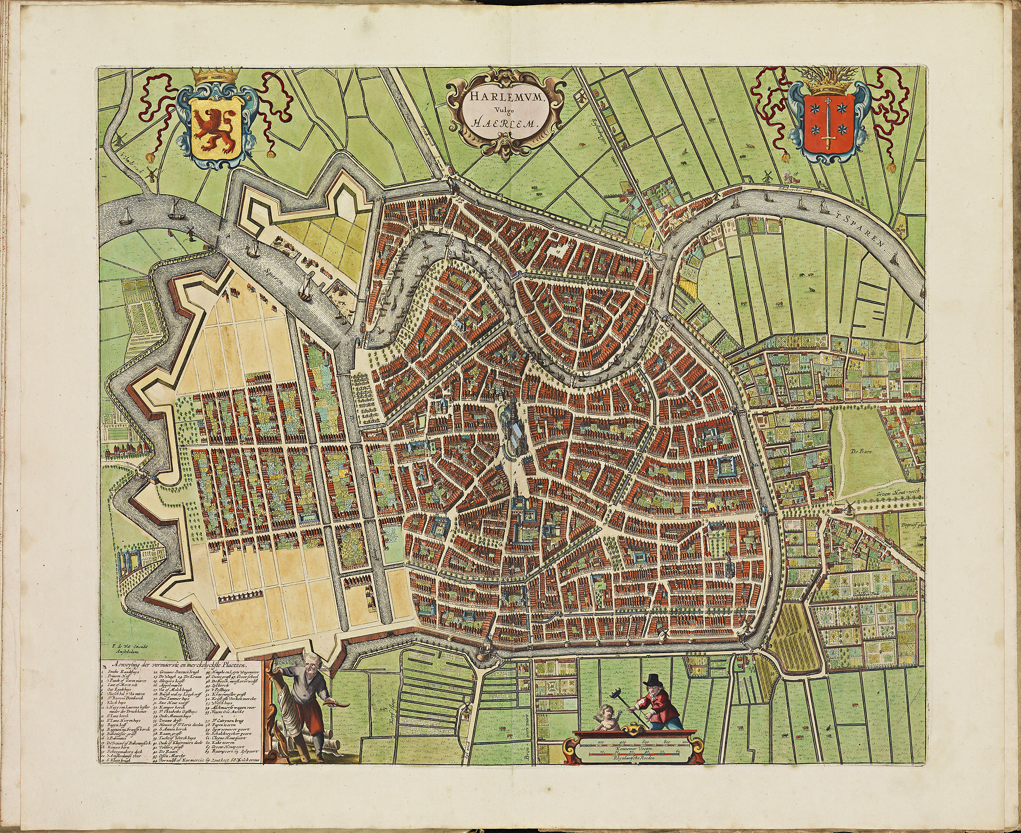
The maps in this atlas are extremely detailed. This makes them very suitable for armchair tourism. Take the map of Haarlem, for example The old centre of the town is so sharply depicted, that anyone who lives there can easily find their own house or pinpoint the route to the Saint Bavo church.
-
Haarlem. The map is so detailed that you can almost walk around in it.
Amsterdam: centre of cartography
In the 16th century, Antwerp was the centre of cartography: the art of making maps. But when the Spanish conquered Antwerp during the Dutch Revolt in 1585, many mapmakers moved north. Amsterdam became the new centre of cartography, where famous mapmakers worked, such as Willem Jansz. Blaeu, his son Joan, as well as Johannes Janssonius. They made the most beautiful atlases. All of them had the ambition to make a book about all the cities in Europe. Blaeu was the first to finish his edition, in 1649. Janssonius followed 8 years later.
At the end of the 17th century, their younger colleague Frederick de Wit appeared on the scene. De Wit bought a few original copper plates from his colleagues and set to work. De Wits’ City Atlas was published around 1698. It shows that he made the necessary adjustments, such as the addition of new buildings and extra explanations. He also named the atlas after himself.
How maps were made in the 17th century
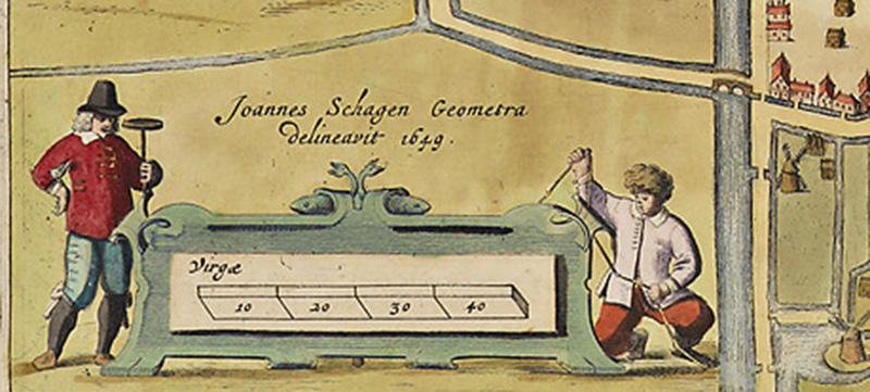
To take measurements for new maps, surveyors walked the streets of a city. They measured the length of the straight stretches by counting the number of steps, or used a measuring chain. At bends, side streets and intersections they measured the direction with a compass. Angles between streets could also be measured with a so-called Dutch circle. This created a network of lines; the skeleton of the map. After that houses, canals, trees and sometimes people were drawn.
The result does not look like the maps we use now. Buildings on these old maps are for instance drawn in a 3D-like, crooked way. Street grids are depicted from above, just like they are on modern city maps, but buildings and other objects are shown from the side.
-
Detail from the map of Medemblik. On the left a surveyor with a Dutch circle, which is used to measure the angles between the streets. On the right a surveyor with his measuring tape.
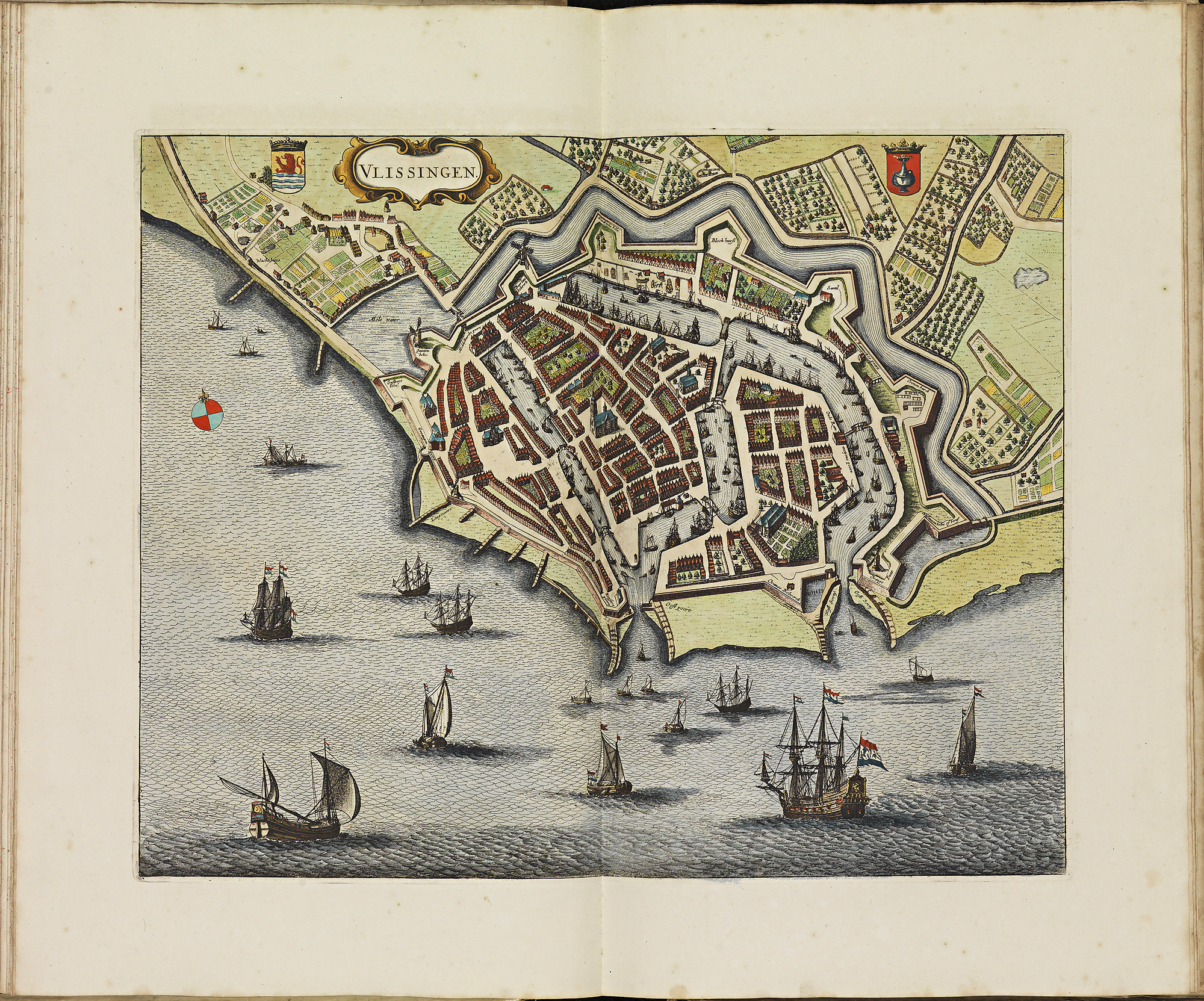
-
Vlissingen. You see the city from above, but houses, ships and trees from the side.
How maps were printed in the 17th century
In the 17th century, the maps were firstly drawn by an artist. Subsequently, they are engraved (cut or etched) by an engraver on a copper plate. This is done in mirror image. In the latter technique, the lines are etched out with acid.
Printing an engraved map is a lot of work. In order to print only the lines, the entire plate first needs to be covered in ink. The surface is then cleaned so that the ink only remains in the grooves. Finally, the plate is printed on slightly damp paper.
In that age, printing could only be done in one color at a time. Someone who wanted the maps in colour, could opt to have them coloured by hand by so-called 'setters'. The KB copy is hand-coloured, but most known copies are in black and white.
The City atlas De Wit in the KB
The Atlas De Wit was acquired in 2010 with the support of the Mondriaan Foundation, the VSB Fund and the Friends of the KB. The City atlas De Wit measures 55 by 38 centimeters and weighs more than 7 kilos. This copy contains 126 sheets: 108 sheets with plans and 18 sheets with pictures. A total of 127 cities in the Low Countries are depicted.
Reprint of City atlas De Wit
In 2012, Lannoo Publishers and the KB jointly produced a facsimile (complete reprint) of the City atlas De Wit, with an introduction by the KB’s former curator of old prints Marieke van Delft and cartographer Peter van der Krogt. The book is sold out, but can sometimes be obtained second-hand.
How to view the City atlas De Wit
The original book can be viewed by researchers in the KB. The title is Theatrum ichnographicum omnium urbium et præcipuorum oppidorum Belgicarum XVII Provinciarum peraccurate delineatarum. (Or, in Dutch: Perfecte aftekeningen der steden van de XVII Nederlandsche Provincien in platte gronden. Or, in French: Le theatre des plans de toutes les villes qui sont situéez dans les XVII Provinces du Pays Bas parfaictement déseignéez. t'Amsterdam) by Frederik de Wit, [after 1698]. It has 126 leaves. You will find this masterpiece in the KB catalogue under request number KW 1046 B 16.
You can also browse through the digitized book. You can download and reuse the plates separately via Wikimedia Commons.
Read more about the City atlas De Wit
Books
- Koeman, C. Atlantes neerlandici: bibliography of terrestrial, maritime and celestial atlases and pilot books, published in the Netherlands up to 1880. Amsterdam: Theatrum Orbis Terrarum, 1967-1985.
- Krogt, P. van der. The Town Atlases: Braun & Hogenberg, Janssonius, Blaeu, De Wit, Mortier and others. Atlantes Neerlandici.
- Wit, F. de. Atlas De Wit: stedenatlas van de Lage Landen. Lannoo.
Articles
- Nijhoff, N. 'Het stedenboek van F. de Wit'. Het boek 23 (1935/36), p. 353-366.