Atlas Ortelius
The Atlas Ortelius is the first 'modern' world atlas. Antwerp mapmaker Abraham Ortelius (1527-1598) had a number of existing maps redrawn in a standard format and published as a book. The KB owns five different copies. We highlight one of them here. This 1571 copy is special because it contains only Dutch texts, instead of Latin ones as well. It depicts 53 maps to which additions were made later in time.

Browse through this masterpiece
Provenance of the Atlas Ortelius
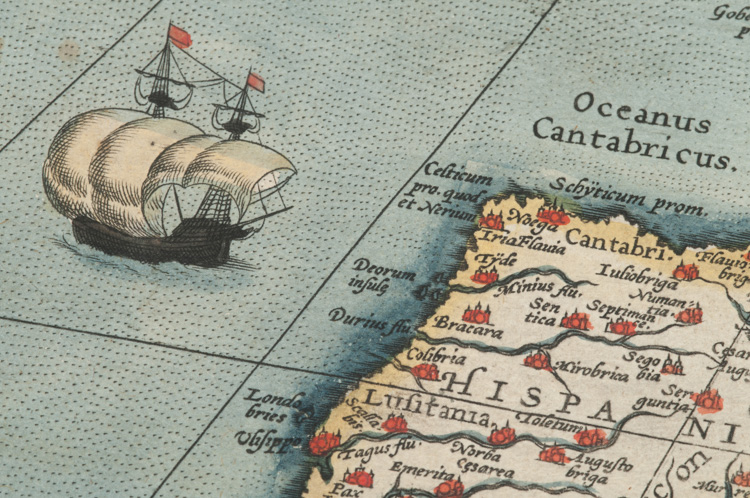
In Ortelius' time there were no atlases as we now know them. Sailors used individual maps and composite atlases were made to order. These usually contained maps in different sizes and layouts. Ortelius was the first person to create a 'modern' atlas: a collection of maps bound in a book that were uniform in size and layout. In order to create the atlases, the maps were (re)engraved in copper. Ortelius’ first edition was published in Latin in 1570. The first Dutch edition followed a year later.
We know that the texts in the 1571 edition weren’t translated from Latin, but written directly in Dutch. The phrasing shows that a general, non-scientific audience was targeted. Ortelius wrote, for example, that The Hague was “the best village in Europe”. The atlas was an immediate success. New editions were published with more maps, and also translated into German, French, Spanish, English and Italian.
How did the KB obtain this copy of the Atlas Ortelius?
This Dutch copy was owned by the Hommes family, and was handed down to the Dordrecht-based Van der Lynden banking family. The KB purchased the atlas in 2013 with the support of the Friends of the KB. The book is a valuable item in our cartographic collection, which contains a large number of old atlases (approx. 350) and old maps (approx. 2,500).
-
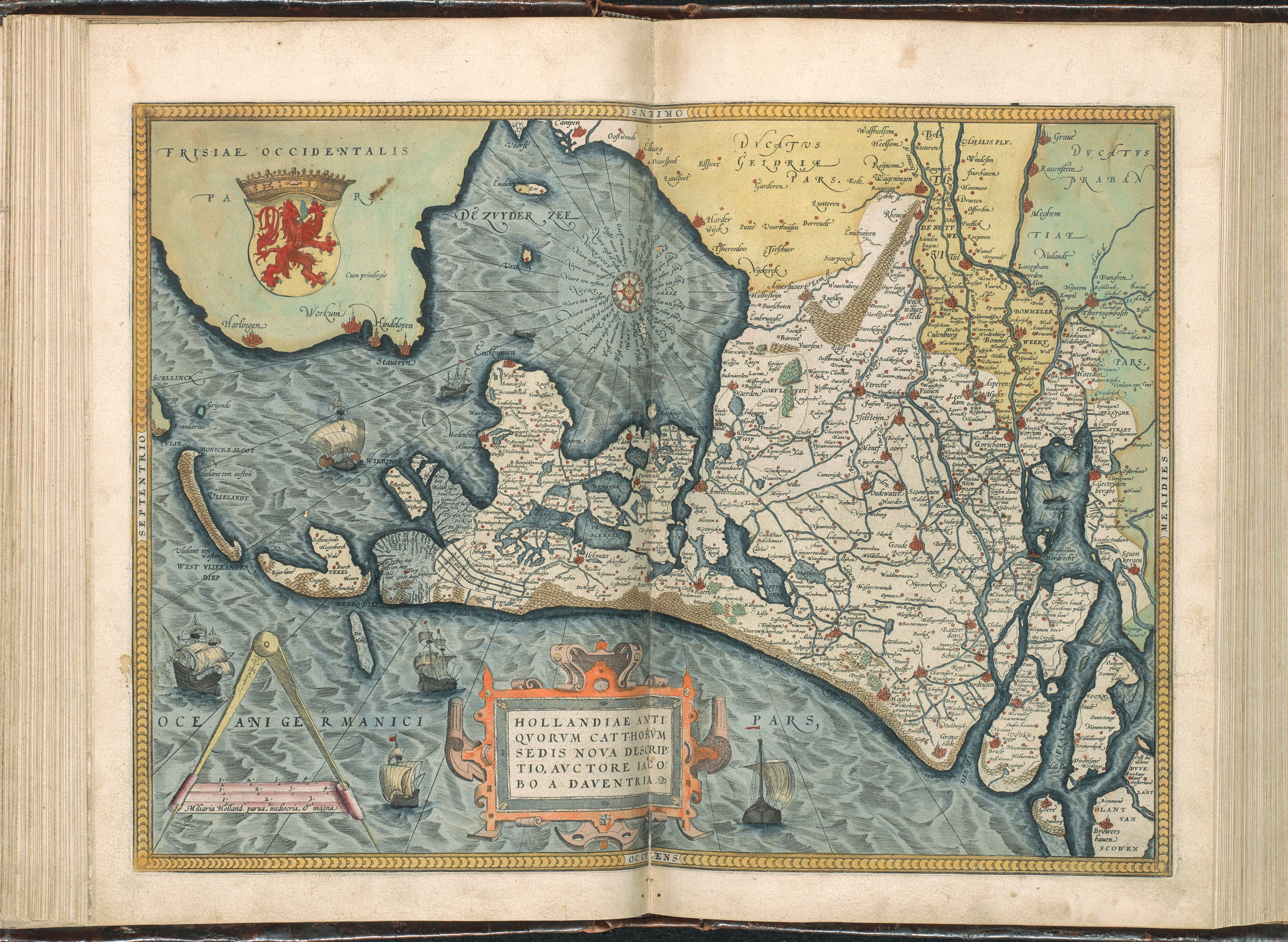
Striking about Ortelius' Atlas is that the north is not always depicted at the top of the page. In the 16th century, the placement of the north was not yet standardized. Cost efficiency was leading in how the map was placed on the plate. This led, for example, to an unexpected map of the Netherlands (map 35) on which the North Sea is visible at the bottom of the page.
How to view the Atlas Ortelius
The Atlas Ortelius can be viewed upon request in our reading room. KB members can place such a request by entering KW 1046 B 17 in the KB catalog. You can also view this masterpiece online. This can be done via the digitized book of the Atlas Ortelius or on the Atlas Ortelius page on Wikimedia Commons.
Read more about the Atlas Ortelius
The following books about the Atlas Ortelius are available in the KB reading room:
- M. van den Broecke, Ortelius' Theatrum Orbis Terrarum (1570-1641). Characteristics and development of a sample of on verso map texts. Utrecht 2009.
- M. van den Broecke, Ortelius atlas maps. An illustrated guide. 2e herziene druk. ’t Goy-Houten 2011.
- C. Koeman (comp., ed.), Atlantes neerlandici. Bibliography of terrestrial, maritime and celestial atlases and pilot books, published in the Netherlands up to 1880. Amsterdam, 1967-1985; dl. III, nr. Ort 31
- P. van der Krogt, Koeman's Atlantes neerlandici; III: Ortelius's Theatrum orbis terrarum, De Jode's Speculum orbis terrarum, The Epitome, Caert-thresoor and Atlas minor, The atlases of the XVII provinces, and other atlases published in the Low Countries