Atlas of Dirk van der Hagen
The Atlas of the Amsterdam merchant Dirk van der Hagen contains more than 400 maps and prints of all parts of the world. It is an atlas factice. That means that the atlas is compiled from maps, prints, engravings and other material.
Contents of the Atlas of Dirk van der Hagen
In Dirk van der Hagen's Atlas you will find topographical and folding maps, among other things. The most important countries from each continent are included. The atlas also contains pictures of historical events, such as wars. Furthermore, news prints, cityscapes and panoramas are depicted.
In the atlas you will not only find images, but also text. These are often explanatory texts, but also praise poems: poems in which someone is praised. The atlas thus provides a personal picture of what the collector apparently found important and beautiful. In addition, the contents of the atlas provides an image of a specific time.
The atlas consists of 4 parts:
- World map, Northern and Eastern Europe, Russia - with a series of 10 coloured prints by Romeyn de Hooghe about the war with the Turks;
- United Kingdom, Netherlands and Belgium - with engravings by Romeyn de Hooghe about political events around 1688, the year of the Glorious Revolution;
- Spain, France, Italy, Greece - with prints by W. Swidde about Versailles and Rome, which together provide a beautiful picture of cities in the 17th century;
- Asia, Africa, America, South Pole - with prints from travel reports, such as those by Johan Nieuhof.

Browse through this masterpiece

Browse through this masterpiece

Browse through this masterpiece

Browse through this masterpiece
Why is Dirk van der Hagen's atlas so special?
Many factions from the 17th century have unfortunately been lost. That is why the Atlas of Dirk Van der Hagen is a rare example of this type of atlases. The atlas has been completely edited (coloured), probably by master compositor Dirk Jansz. Van Zanten. Van Zanten was the very best colourist of atlases and books in the last quarter of the 17th century. He probably worked on such a project for years. Van Zanten used special colours, expensive pigments and even gold leaf for this atlas.
The maps were made by the most important Dutch publishers in the 17th century, such as Willem and Joan Blaeu, Claes Jansz. Visscher, Nicolaes Visscher, Frederik de Wit and Johannes Janssonius. The prints were made by famous engravers, such as Romeyn de Hooghe and Willem Swidde. The Atlas also contains many prints that were made for travel reports, such as those by Johan Nieuhof about his trip to Asia.
-
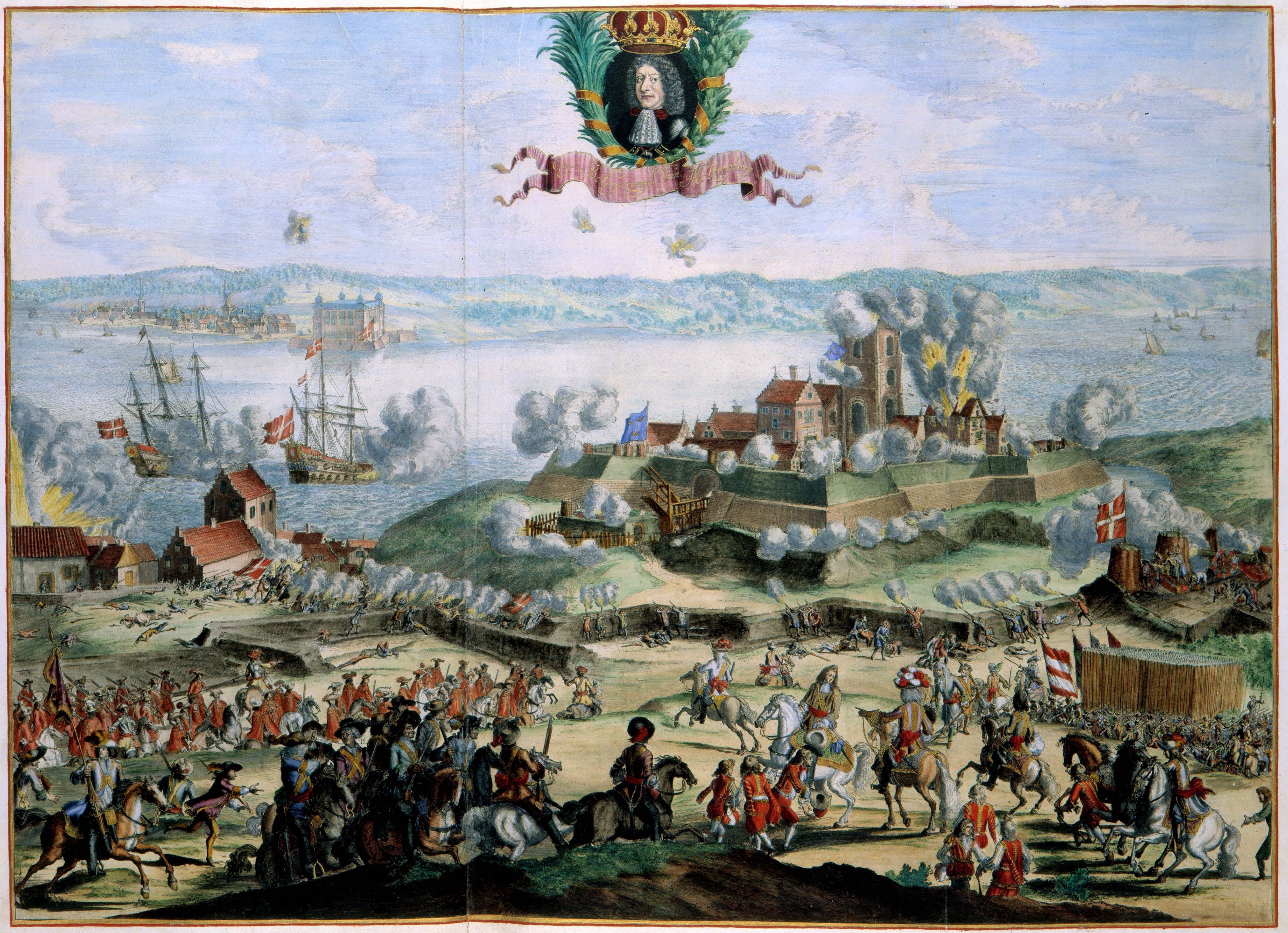
Image of the siege of Helsingborg, Sweden from the atlas.
Who compiled the Atlas of Dirk van der Hagen?
The book is now generally known as the Atlas Van der Hagen. However, it is not entirely certain that Dirk van der Hagen compiled the atlas. The atlas was attributed to him on the basis of an advertisement in the Amsterdam Courant of July 24 and August 26, 1710: ‘sal men verkopen [...] een Atlas in 4 deelen, overkomstig afgeschildert door Dirk Jansz. van Zanten, [...] nagelaten by wylen de Hr. Dirk van der Hagen’ ('shall one sell [. ..] an Atlas in 4 parts, depicted accordingly by Dirk Jansz. van Zanten, [...] left by the deceased mr. Dirk van der Hagen').
So the origin seems clear. However, we also know of an earlier newspaper advertisement published on September 14, 1702 that announces the sale of ‘een Atlas in vier deelen, in ider 100 kaarten [...] extraordinary afgeset door Dirk Jansz. Van Zanten, nagelaten by wylen Jan Bus’ ('an Atlas in four parts, each containing 100 maps [...] extraordinary set by Dirk Jansz. Van Zanten, left by the deceased Jan Bus'). This could mean that Dirk van der Hagen bought the atlas in 1702 and that Jan Bus was the collector. Or that this regards a completely different atlas. That is something that still needs to be researched. Then we might also find out who originally bought the atlas.
-
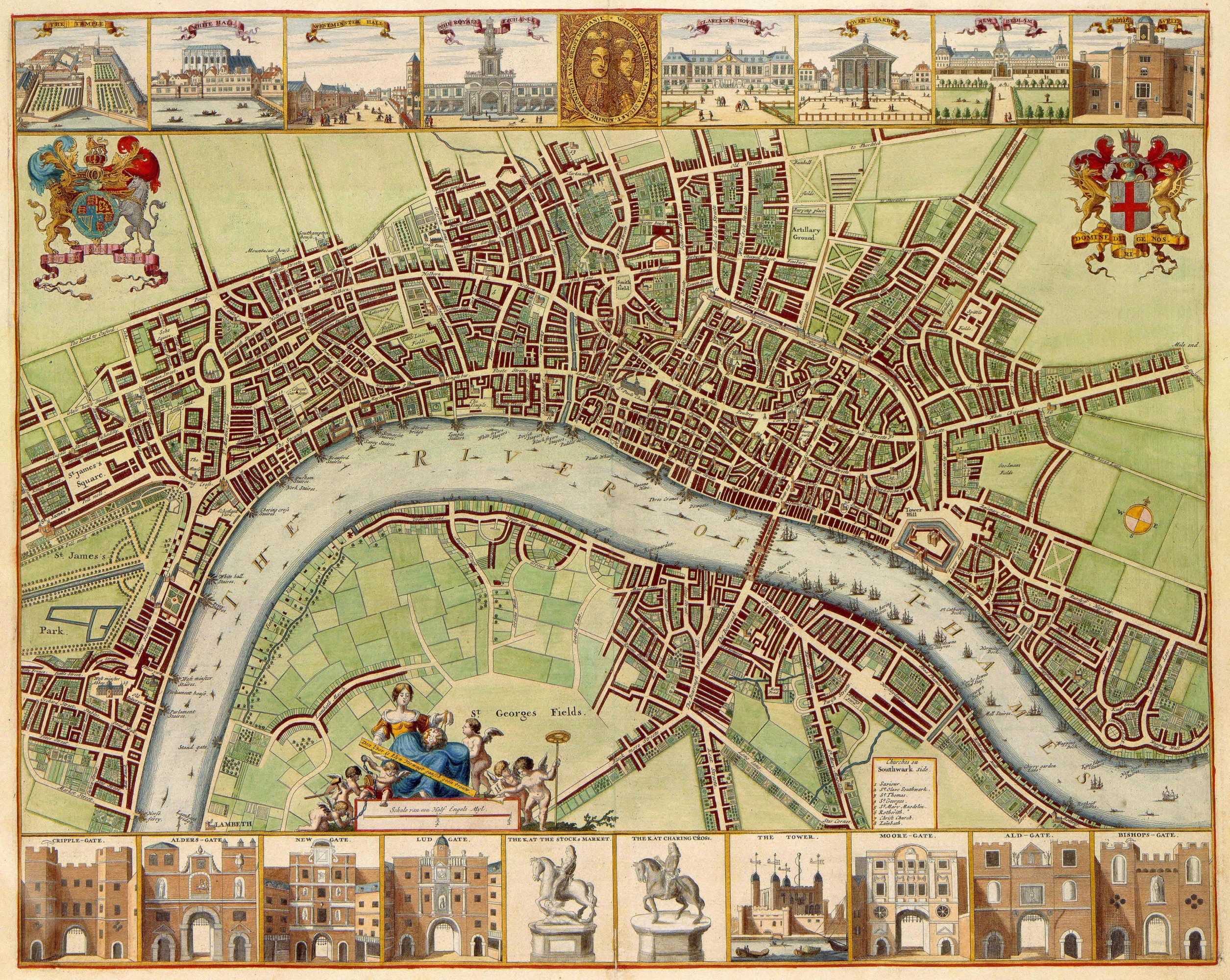
Map of London from the Atlas of Dirk van der Hagen.
Who was Dirk van der Hagen?
Dirk van der Hagen (1645-1710) was from Dordrecht. He was the son of the lawyer Hermanus van der Hagen and Ida Nicolai. In 1632 he married Maria van Anstenraet, daughter of Isaac van Beest and Aeltje Becx. His last known address in Amsterdam is Keizersgracht 101
How did the Atlas of Dirk van der Hagen end up at the KB?
The Atlas Van der Hagen has been in the possession of the National Library of the Netherlands since 1887. We received the atlas from the estate of P.J.B.C. Robide van der Aa.
-
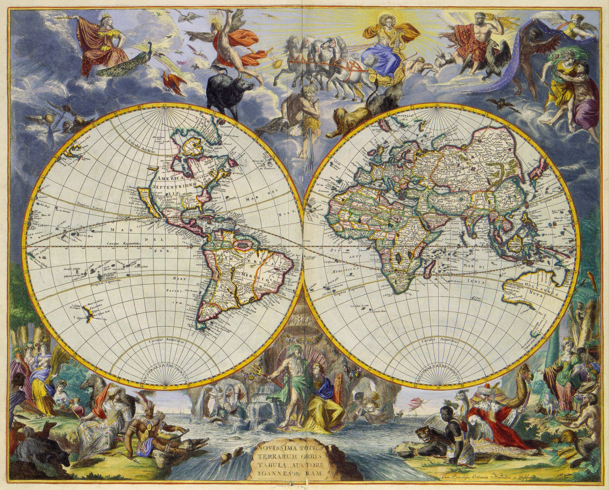
World map from the Atlas of Dirk van der Hagen.
How to view the Atlas of Dirk van der Hagen
The Atlas Ortelius can be viewed upon request in our Special Collections reading room. The request number is KW 1049 B 10 [-13]. The digitized book contains additional information about the subject and the makers for each map or print. Images of this work can be viewed via Wikimedia Commons.
References
Books
- Goedings, T. & Veen, S. van der (red.). 'Afsetters en meester-afsetters' : de kunst van het kleuren 1480-1720. Nijmegen, 2015.
- De wereld binnen handbereik. Nederlandse kunst- en rariteitenverzamelingen, 1585-1735. Zwolle/Amsterdam, 1992.
- Een wereldreiziger op papier. De atlas van Laurens van der Hem (1621-1678). Amsterdam, 1992.